This is the first of two posts describing the first day of the Barjarg-Harpers Rd burn. This post, a rather lengthy one, examines what was planned for this burn and what we saw on Day 1.
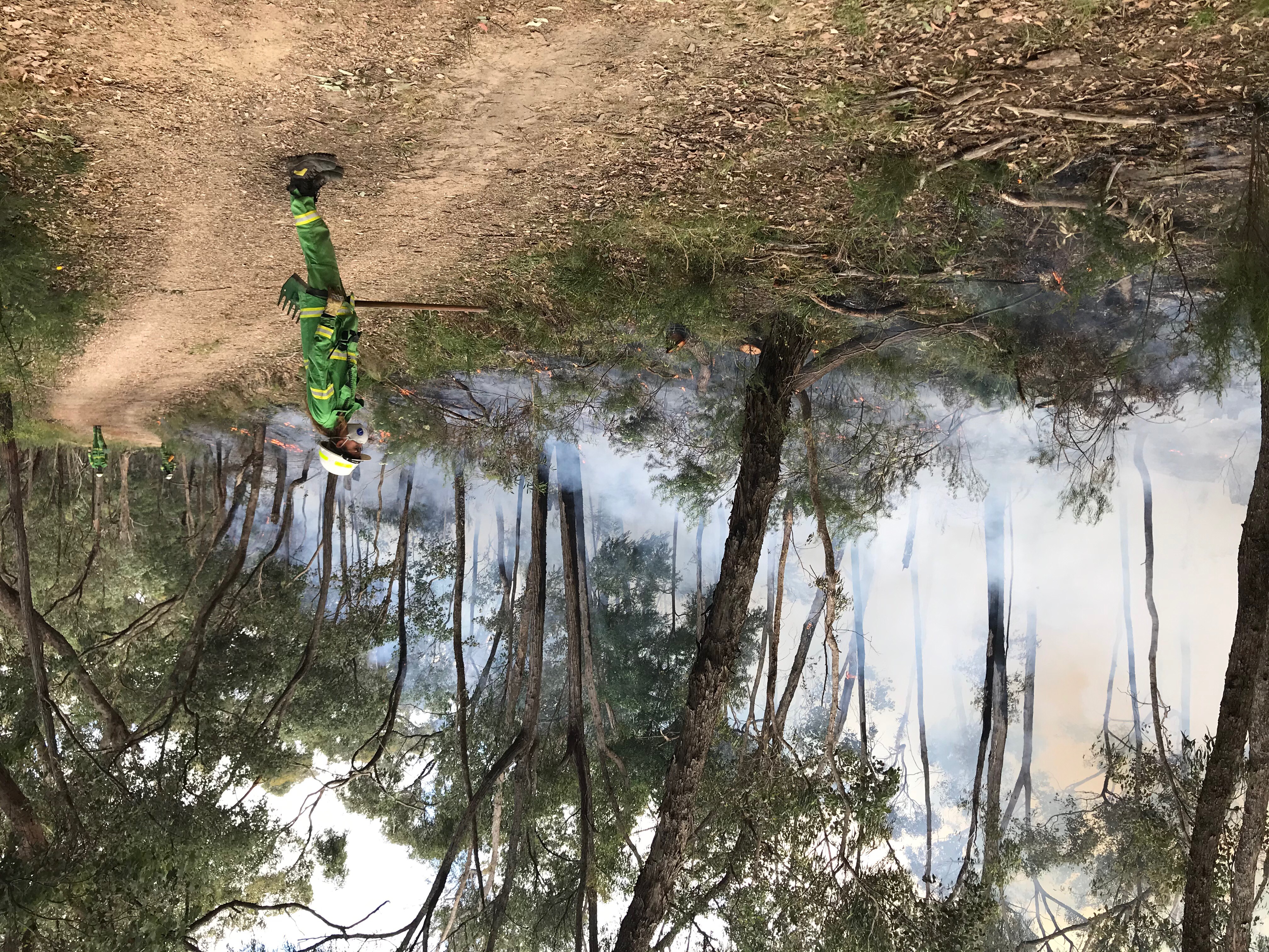
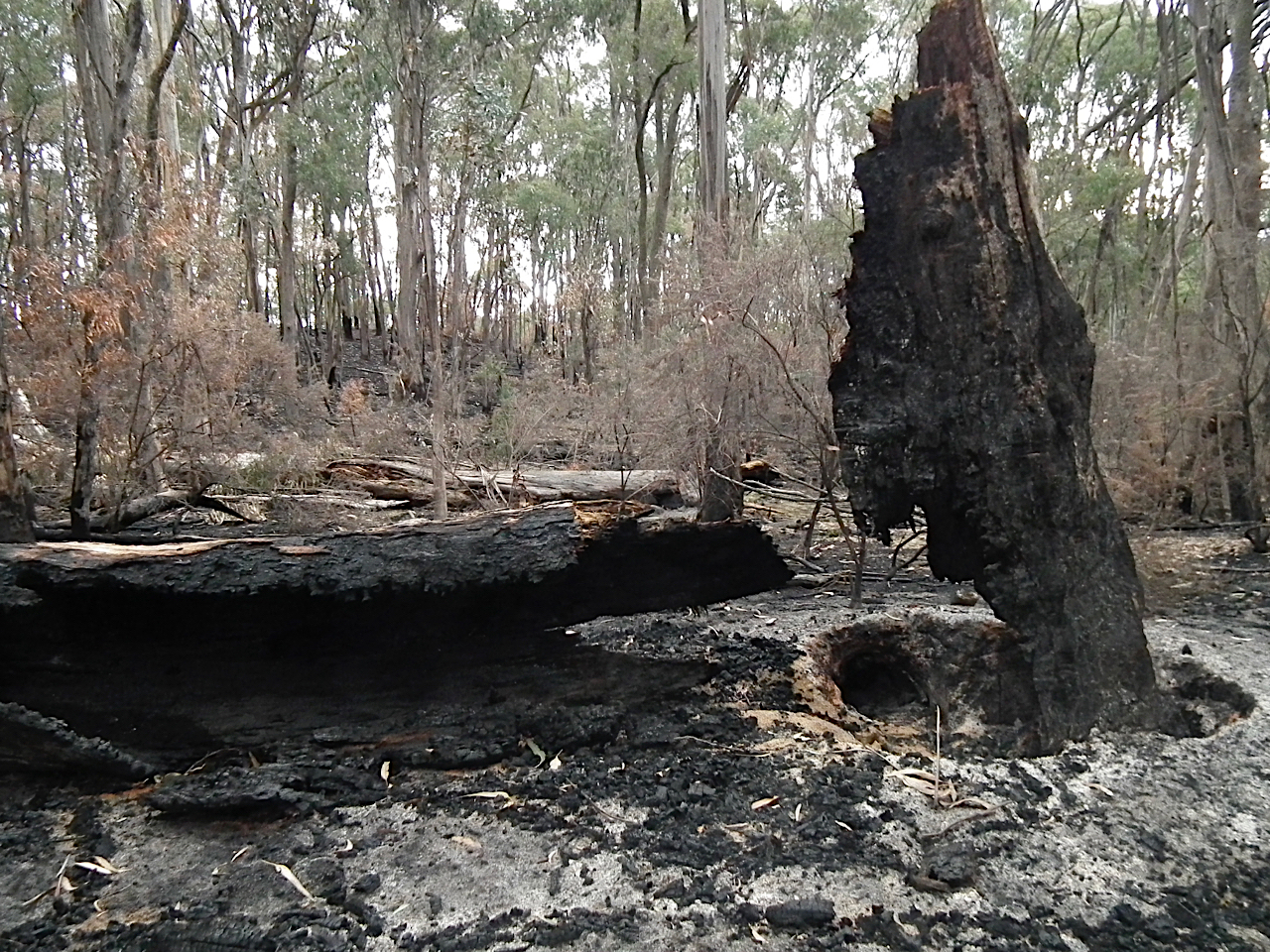
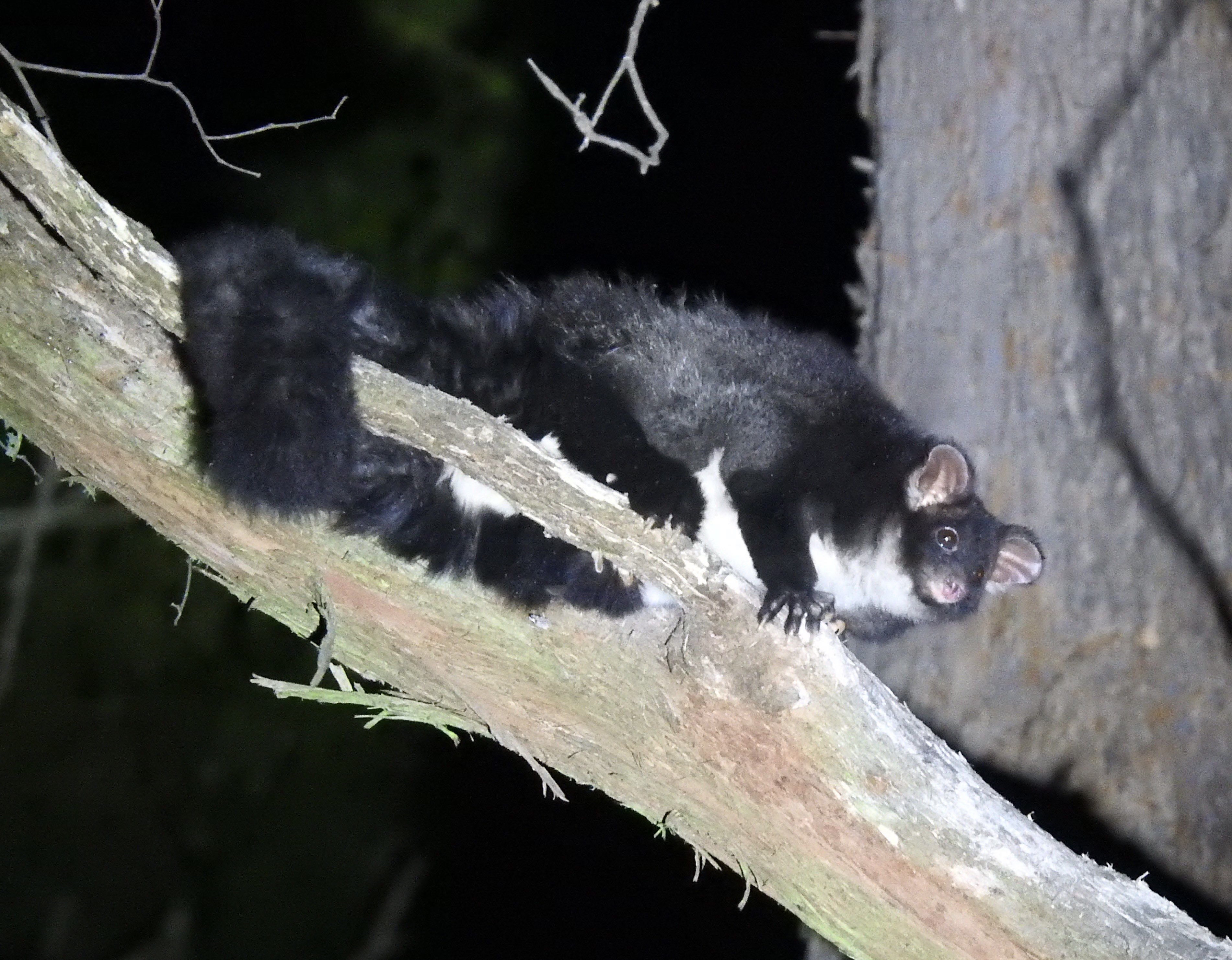
On May 8, 2024, a 540 ha area of the Strathbogie Forest was set alight as part of DEECA’s planned burn program (for fuel reduction). Known as the Barjarg-Harper’s Rd burn, this forest is home to the nationally endangered Southern Greater Glider (Petauroides volans).
As described in communication with Victoria’s Chief Fire Operator, the burn delivery plan shows there are ignition lines along virtually every ridge across the entire 540 hectares of the burn (see also map, below). This appears surprising given the threat fire poses to the species and that the area “was part of recent monitoring project which detected high densities of Southern Greater Glider. It is likely this species occurs throughout Foothill Forest within the broader burn footprint – especially along gully and drainage lines where larger hollow-supporting trees are numerous.” (DEECA Barjarg-Harpers Rd Delivery Plan, 3-7-2023).

As well as including the above map, the Delivery Plan notes several mitigation measures to reduce the impact of the burn “on this important area for Greater Glider” the most pivotal of which is to:
- “Ensure that fuel moisture differentials are sufficient that they moderate against higher intensity burn coverage and exclude fire from damper drainage lines and gully systems.” (Ibid.).
The Delivery Plan also notes that burn coverage is expected to be >60% and that the “Burn unit has significant variability in topography and slope” (Ibid.).
The nature of the Delivery Plan seems particularly problematic for the Southern Greater Glider given DEECA’s own research has found that, of all the hollow-bearing trees in the study that were reached by fire (273 trees), 52% of those trees either collapsed or sustained serious structural damage.
Even more curious is the location of the burn exclusion zones, where fuel will not be reduced. These include those parts of the forest closest (within several hundred meters) to people and houses. In other words, fuel hazard reduction is excluded from precisely those areas where peer-reviewed research tells us fuel management is most beneficial – “Clearing vegetation around houses was at least twice as effective as recent prescribed burning in the near vicinity for protecting houses on Black Saturday (Dr Geoff Cary pers. comm. to ABC Science 2012) (also Gibbons et. al. 2012, Leonard 2020).
Now, call me risk averse, but igniting most ridge-lines in a topographically complex burn area (with very steep slopes, up to 22 deg/40%), to achieve a burn coverage of >60%, excluding fuel hazards closest to assets, all while trying to maintain a healthy population of a nationally endangered species, appears fraught. A bit like Wilhelm Tell’s dilemma – not much margin for error and perhaps misguided from the start!
Is DEECA genuinely concerned about the impact this planned burn could have on a nationally endangered species, or is the risk of impacting the Southern Greater Glider considered acceptable collateral damage? How can DEECA even assess whether its Delivery Plan mitigation measures for the Southern Greater Glider have been successful?
Continue reading